


The Chinese Glacier with Three Names
Updatetime:2017-11-02From:
【Enlarge】【Reduce】
Planning the Visit to the Glacier
The possibility of a field trip came up early in my correspondence with Shichang Kang, a prominent Chinese geoscientist, as we planned my visit to his research institute in the central province of Gansu. The itinerary that I received last August, a month before my arrival, included a nine-day stay at the institute Kang directs, the State Key Laboratory for Cryosphere Science (SKLCS), in Lanzhou, the capital of Gansu. After that, I would take a five-day field trip, in which I would “visit two stations (desert and glacier),” as Prof. Kang told me, and see oases.
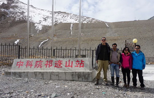
At the entrance to the Qilian Glacier Station. Left to right: Ben Orlove, Chhatra Sharma, Shengxia Wang, Hongju Cheng (source: Yong Li).
The desert was the Gobi Desert. And the glacier, I was told, would be in the Qilian Mountains. This range, which marks the northeastern edge of the Tibetan plateau, is not as famous as some of China’s other, higher ranges, but nonetheless still significant, with peaks up to 5500 meters.
As my correspondence with the SKLCS continued, the name of the glacier did not come up, since my colleagues and I were focused on plans for the lectures that I would give in the first half of my visit. The SKLCS was seeking to expand the social science component of its research program, to include aspects of risk assessment and adaptation. The field trip, I understood, would help me understand the climate change impacts across western China, and contribute to my discussions with the lab.
During my first week in Lanzhou, I gave three talks and had many conversations with researchers at the SKLCS. I had the chance to see the papers that the lab had produced. In some of these, focused on glacier retreat and on transboundary movement of pollutants, I saw references to a “Glacier Number 12” in the Qilian Mountains, as well as others in the Himalayas and the Tien Shan. It seemed likely that this would be the one I would visit, since it had a research station at it. Its number reflected its position in the national glacier inventory.
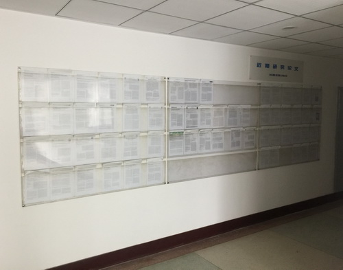
Research papers on display at State Key Laboratory for Cryosphere Science (source: Ben Orlove).
Our conversations focused, not on individual glaciers, but on the Qilian as a whole, and on the “Hexi Corridor,” the stretch of desert territory west of Lanzhou that I would visit. It is the eastern end of the Silk Road, I learned. For centuries its oases have been watered by rivers that originate in Qilian glaciers, but they now face an uncertain future, with climate change and glacier retreat. Moreover, this region is a key to Chinese development. It serves as a link to the western provinces of Qinghai and Xinjiang, which are poorer than coastal regions of China, and it connects with the countries in Central Asia and beyond, where China is promoting ties through infrastructure projects and investments through its One Belt and One Road Initiative, also known as the Belt Road Initiative (BRI). In this initiative, the Silk Road serves as an important precedent and symbol for Chinese trade and engagement beyond its borders.
Driving to the Mountains
When we set off from Lanzhou on 14 September for the field trip, I still had not learned whether the glacier would have a more vernacular name, or whether it was known only by its number. Five of us left Lanzhou. In addition to myself and the driver, the group in the SUV included two researchers from SKLCS, Dr. Shengxia Wang and Hongju Cheng, and Dr. Chhatra Sharma, an environmental hydrologist from Kathmandu University who has collaborated with SKLCS for nearly 10 years.
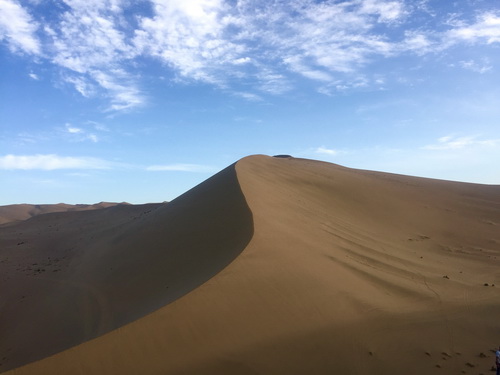
Dunes in the Gobi Desert in western Gansu province (source: Ben Orlove).
To reach the glacier, we would travel more than 1000 kilometers to the northwest. Our route toward it took us through landscapes that grew ever more arid. The irrigated regions of villages along tree-lined roads, with fields of maize and sorghum, grew smaller, as the unwatered areas between them became larger and drier, shifting from low brush to grasslands and finally to bare sand. The larger oasis towns had tall apartment blocks, though the older villages still consisted of low buildings, many with internal courtyards.
We visited agricultural research stations, where dryland crops and new greenhouse technologies were being developed. We saw new hotels, shops and visitor centers oriented toward China’s rapidly expanding internal tourism market; they showed off western Gansu’s attractions, such as oasis wetlands, striking geological formations, sand dunes, and ancient caves, filled with murals and sculptures, where Buddhist monks prayed and meditated.
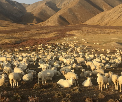
Sheep in grasslands in the Qilian Mountains (source: Ben Orlove).
And finally the day of the glacier visit arrived. We awoke early and departed well before dawn for the drive up the Qilian Mountains. The ascent took us through grasslands where nomadic herders camped in yurts, and then up a narrow valley, its bottom filled with rubble.
We arrived at the research station in mid-morning. The director greeted us, as his staff prepared breakfast. The wait gave us a chance to have at least an hour to acclimatize to the altitude; we had ascended nearly 3000 meters to the station, located almost precisely at an elevation of 4000 m.
The director told us of the history of research visits to the glacier since the 1950s and of the station’s founding in 2007. He showed us the rooms where snow and ice samples were stored for shipment to SKLCS in Lanzhou, where they were analyzed.
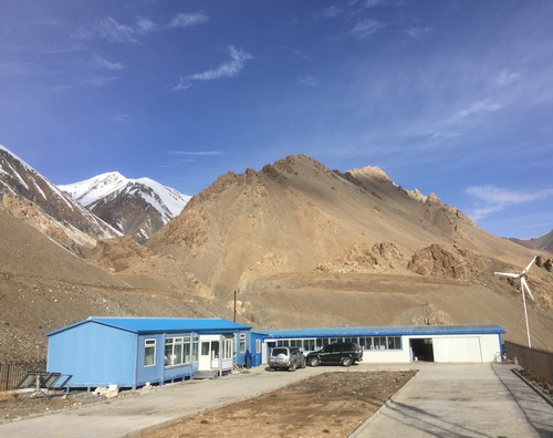
Qilian Mountain Glacier Station (source: Ben Orlove).
And we discussed the glacier itself. It has been shrinking in recent decades, retreating eight meters per year from 1993 to 2005, and then more quickly, at 16 m per year, from 2005 to 2014. Its current length of 10 km makes it the longest in the range.
At the Glacier
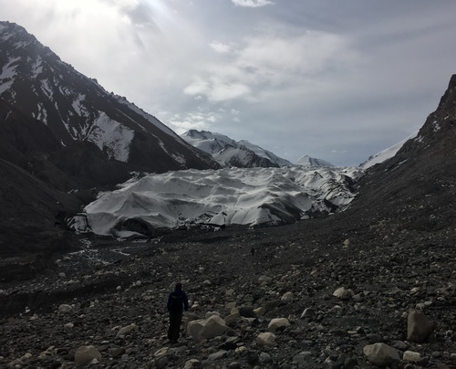
Walking up to the glacier, with a covering of fresh snow (source: Ben Orlove).
After our meal, we set out on the short drive to the glacier itself. We found it to be a classic valley glacier—a thick flat mass of ice that ran from one steep wall of a valley to the other. There was still significant accumulation occurring in the higher zones, we were told.
The glacier tongue was relatively low, at 4300 m. We clambered up a slope of scree, over a large boulder, and onto the surface of the glacier itself. The season’s first snow, a week before our arrival, left a fine white layer on the north-facing portions of the glacier, but we could still see details of the surface. The parts of it that were closest to the valley walls were covered with debris, the result of rockfalls from the steep sides. The portions adjacent to them had thick dust as well.

A frozen meltwater pond on the glacier surface (source: Ben Orlove)
Even though there was no fresh water flowing on the surface, we could see much evidence of melting, with streams that had incised themselves. The scientist who accompanied us confirmed that the flow was limited to the summer months. It was a few degrees below freezing where we stood, and the temperatures higher up were much colder.
We continued our way up. The new snow made the hiking easy. We found a few meltwater ponds on the surface, which had recently frozen solid. And there were some icicles in shaded overhangs, signaling summer melt as well.
We hoped to go further, and reach the automated weather station on the glacier, and see the snow pits that reseachers had dug. But Shengxia Wang, attuned to our safety and well-being, pointed out dark clouds near us, and Chhatra Sharma mentioned how he had been caught in sudden snowstorms in the Nepal Himalayas. We decided to turn around. This move proved prudent, since the snow began to fall before we reached our vehicle.
The Glacier’s Three Names
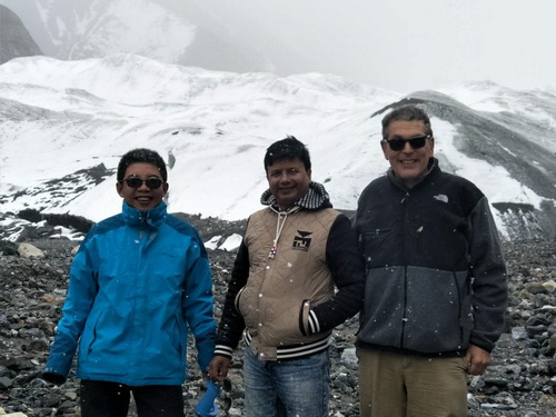
Unexpected snow at the glacier. Left to right: Hongju Cheng, Chhatra Sharma, Ben Orlove (source: Shengxia Wang).
Once we were off the ice, we stopped to take pictures. I asked Shengxia if the glacier had a name, other than Glacier No. 12. She said that its common name, as mentioned in geographical works, was Laohu Gou Bingchuan, Tiger Gorge Glacier, referring perhaps to its shape like a tiger’s tale, or to a story of a tiger that had resided nearby.
And there is one more name, she mentioned, Touming Mengke Bingchuan. She translated that as Green Dream Glacier. I made her repeat the translation, thinking that I had misheard it. She explained that it was the old name from the Mongols, who once had ruled this area; ethnic Mongols are still found in Gansu. She thought that some regional officials could have encouraged the revival of this old name in the hope that it might attract tourists to the mountains.
We speculated on what a green dream might be, and I recalled Noam Chomsky’s famous example of a nonsensical sentence that is grammatically correct, “Colorless green ideas sleep furiously.” (I would later find the first, second and third names used in print.)
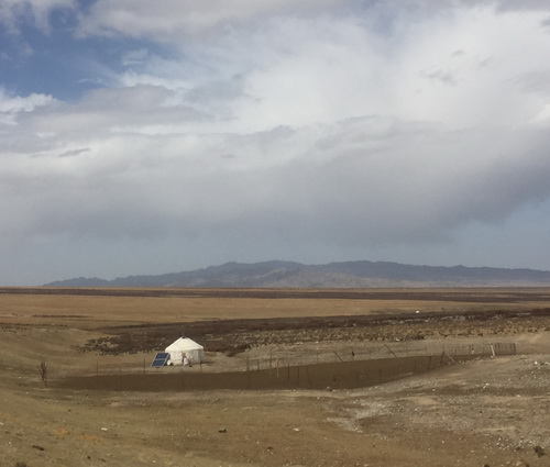
Mongolian yurt in Qilian grasslands, with solar panel, and prayerflags at left edge of corral (source: Ben Orlove).
These names remained in my mind during lunch back at the station, and on our drive back. Partway down, we passed a herd of yaks, and a kilometer or two further on, a yurt, with solar panel, and Mongolian-style prayerflags, with several long streamers attached to the top of a pole. We did not see anyone there, whom we might have asked about green dreams. And, I realized, as we continued back down to the arid Hexi Corridor, the hopes that Chinese have for resilient functioning ecosystems in the face of climate change could also be called green dreams, dreams that are increasingly common in our threatened world. (Glacier Hub)
Appendix
