Land Surface Variables Eastimated from ASTER Remote Sensing Data in ‘ Three Rivers ’ Area of Tibetan Plateau
Updatetime:2010-12-07From:
【Enlarge】【Reduce】
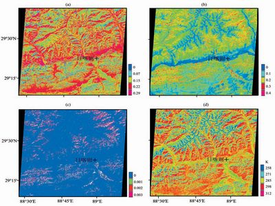
Using the ASTER data, the visible and near\|infrared band and the short wave infrared band, the land surface variables (Land Surface Temperature, albedo, NDVI and Pv) in the Shigatse area, which is representative station of three Rivers Regions (Yarlung Zangbo river, Lhasa river and Nianchu river), in central Tibet Autonomous Region on 27 November 2001 are retrieved. The result shows that in mountain area, the values of vegetation index is less than river valley. ASTER remote sensing data has higher resolution and can get the vegetation status reasonably. At the same time, ASTER has higher ground resolution, so land surface and vegetation variables can show real land surface variables using its data. Further more it points out that ASTER remote sensing data can use in the desert and oasis.
 |
Appendix


