Scientists Predict the Formative Period of Glacial Landforms in the East of Qinghai-Xizang Plateau
Updatetime:2013-10-11From:
【Enlarge】【Reduce】
Qinghai-Xizang Plateau, which has the highest mountain and the widest plateau in the world, is also the largest center of the glacial action except the North Pole and South Pole. So this region is the most actively region for geological structure on Earth. The northwest of the Die shan, as the western segment of the Qinling Mountains, is located in the eastern margin of the Qinghai-Xizang Plateau. Therefore, the research on the distribution and features of Glacial Landforms in the northwest of the Die Shan has important significant for the formative period and processes of the glacier in Qinghai-Xizang Plateau.
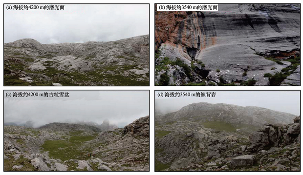
Based on the distribution and features of glacial landforms, considering the present uplift speed of the Qinghai-Xizang Plateau, the available dating data of the glacial landforms in the Dalijia Mountain and the data of the palaeoenvironment in the neighboring areas, the results show that the glacial landforms are considered to be formed in the last glacial cycle, especially during the Last Glacial Maximum. The ancient glacier was an ice cap with a maximum area of about 38 km2. Abundant whaleback rocks that present at about 4,200 m a. s. l. indicate that the ancient ice cap had a warm bottom.
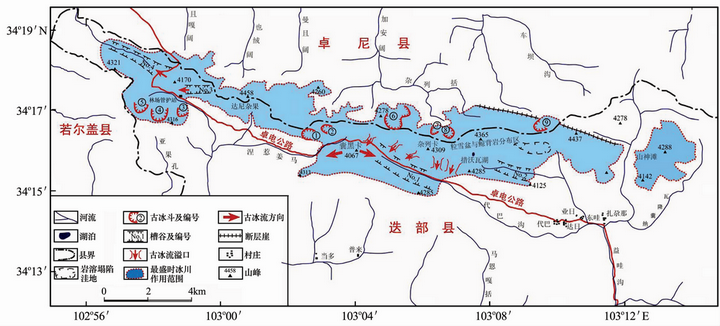
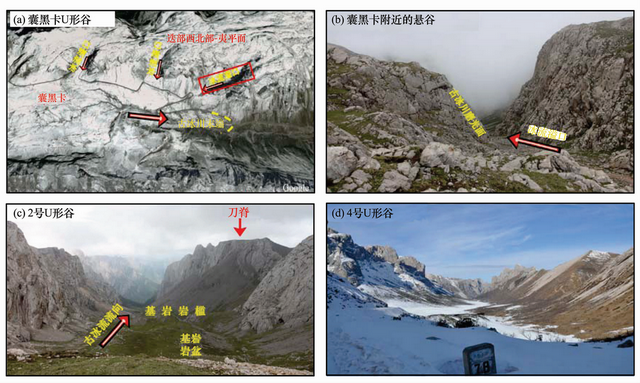
Scientists from CAREERI (Cold and Arid Regions Environmental and Engineering Research Institute) investigated the glacial erosional and depositional landforms during this field research, the objects of the research included cirques, U-shaped valleys, hanging valleys, palaeo-firn basins, whaleback rocks and polished bedrocks, collected abundant first-hand data. The investigation also found lateral and end moraines were well preserved in this mountainous area above 3,700 m a. s. l. Remote-sensing techniques and field mapping were applied to study the distribution and features of glacial landforms in this area.
The program was financially supported by the National Natural Sciences of China (41071010, 41230743, 41171063), the National Major Sciences Research (2010CB951401), Knowledge Innovation Program of CAS (KZCX2-EW-QN304), the State Key Laboratory of Cryospheric Sciences, and the Key Laboratory of Tibetan Environment Changes and Land Surface Processes, CAS. The paper has been published in the Journal of Glaciology and Geocryology, Vol.35 No.4, Aug. 2013.

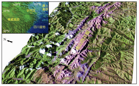
Fig.1 Digital elevation model of the northwest of the Die Shan

Fig.2 Distribution map of glacial landforms in the northwest of the Die Shan

Fig.3 U-shaped valleys in the northwest of the Die Shan

Fig.4 Polished bedrocks (a, b) palaeo-firn basin (b) whaleback rock (c) in the northwest of the Die Shan

Fig.5 Moraines in the northwest of the Die Shan
Appendix


