The Remoting Sense is Applied in New Area: Identification and Extraction of Historical Agricultural Irrigation Canals
Updatetime:2013-10-17From:
【Enlarge】【Reduce】
Irrigation is a necessary condition for the historical agricultural production and development in the arid and semi-arid regions. The artificial irrigation canal, as the most important water delivery facility in the irrigation system, is the main symbol of the agricultural production and development in arid regions. The research on agricultural irrigation canals in arid region is an important proof for understanding the processes of the irrigation agriculture and irrigation canals at different historical periods. Therefore, the research has the important guiding significance for studying the regional environmental change at the historical period. Many archaeological data and historical documents indicate that there were glorious agricultural civilizations during different historical periods, and also played an important role in the ancient Silk Road.
Scientists from CAREERI (Cold and Arid Regions Environmental and Engineering Research Institute) selected the Lücheng as the research region, studied the water delivery facility in ancient period and the regional environmental change.
The ancient Lücheng reclamation area was the largest cultivated area of the ancient Juyan Oasis in the downstream of the Heihe River Basin, and there were many remaining relics of past human activities related to farming between nebkhas and sand dunes there. In this study, based on historical documents and archaeological reports, combined with high-resolution remotely sensed data and canal field investigation data, historical agricultural irrigation canals in the study area were identified according to the linear and texture features of the artificial canals appeared in the study area were identified according to the linear and texture features of the artificial canals appeared in the remote sensing images. It was found that there were large-scale irrigation systems developed to support the flourishingly human agricultural activities for the agricultural irrigation methods between historical agricultural irrigation canals and the modern irrigation system of arid regions in China. Spatial distribution of the agricultural irrigation canals with fine-scale is the direct evidence of the human agricultural activities during the past times in the ancient oasis, which could play an important role in the study of past water conservancy facilities and regional environmental change.
This program is financially supported by the National Sciences Fund for Distinguished Young Scholars (NSFDYS) (40925004) and the National Natural Sciences Fund of China (40901095, 41101388). The paper has been published on the Journal of Desert Research, Vol.33 No.5, Sep. 2013. Full text please see: http://zgsm.westgis.ac.cn/EN/volumn/current.shtml
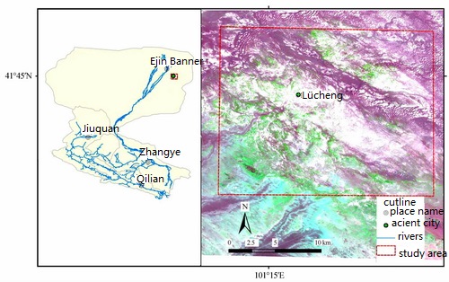
Fig.1 Sketch map and ETM+ image of the studied area (Image by CAREERI)
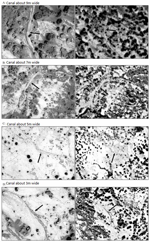
Fig.2 Features of the historical irrigation canals in high-resolution remote sensing images, which the arrows indicate the locations of canals with width of 9.0m (A), 7.0m (B), 5.0m (C), and 3.0m (D). Left images are the Geoeye images and right images are the CORONA imaged (Image by CAREERI) Fig.5 Historical irrigation system identified from remote sensing images (The arrows show the direction of water delivery) (Image by CAREERI)
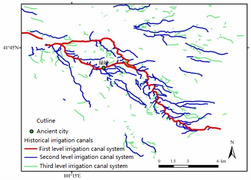
Fig.3 Spatial distribution of the historical irrigation canals identified from remote sensing images (Image by CAREERI)
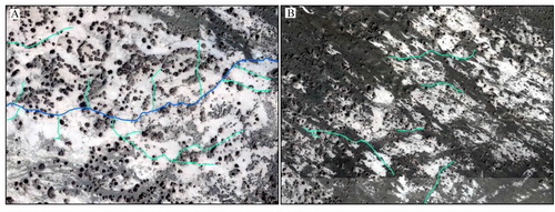
Fig.4 Third historical irrigation canals of delivering water to farmlands (A) and third irrigation canals segments with severe damages (B) identified from remote sensing images (Image by CAREERI)
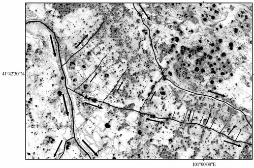
Fig.5 Historical irrigation system identified from remote sensing images (The arrows show the direction of water delivery) (Image by CAREERI)
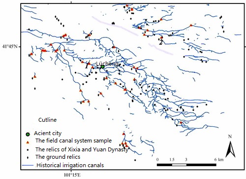
Fig.6 Spatial superposition between the irrigation canals and ancient sites, ground relics as well as sampling canal points investigated during the fieldwork (Image by CAREERI)
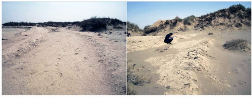
Fig.7 Pictures of the historical agricultural irrigation canals (Image by CAREERI)
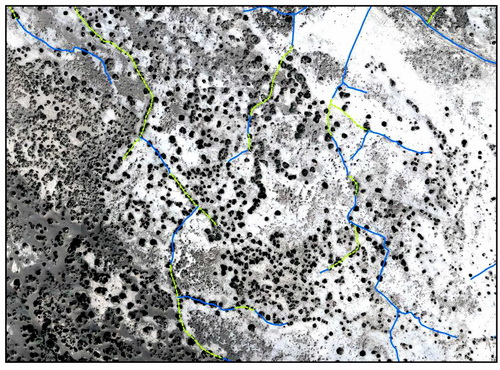
Fig.8 Connect the related segments into an integral irrigation canal by dotted lines, which were cut into some segments by nebkhas or sand dunes (Image by CAREERI)
Appendix


